Dominica Island

Skip the game: all 18 places as a list

Places 0 / 18 Feathers 0

Drag to fly

Drag to steer: the bird flies the way you drag, and glides to a stop when you let go. Arrow keys or WASD fly that way too, Shift to speed up, space to land when a place glows, plus and minus to zoom, L to hear the nearest place.

Fly the island

Be the Sisserou. Glide over a real map of Dominica from sunrise to dusk, collect golden feathers, land on 18 places for a postcard with sourced facts, and try 5 flying challenges.

  • Steer by dragging anywhere, or use the arrow keys. The bird flies where you point it and glides to a stop when you let go.
  • Land when a place glows. Each one opens a postcard and moves the sun along.
  • Explore trails, waterfalls, beaches, bays and more with the layer filters.

Show the list

Reduced motion is respected: the background stays still and the arrow keys move the bird in steps. The list below has every place.

All 18 places, no flying needed

The same postcards as the game, grouped by area. Every fact shows its source. Opening times, access and conditions change, so check locally before you travel.

Soufriere and the south-west

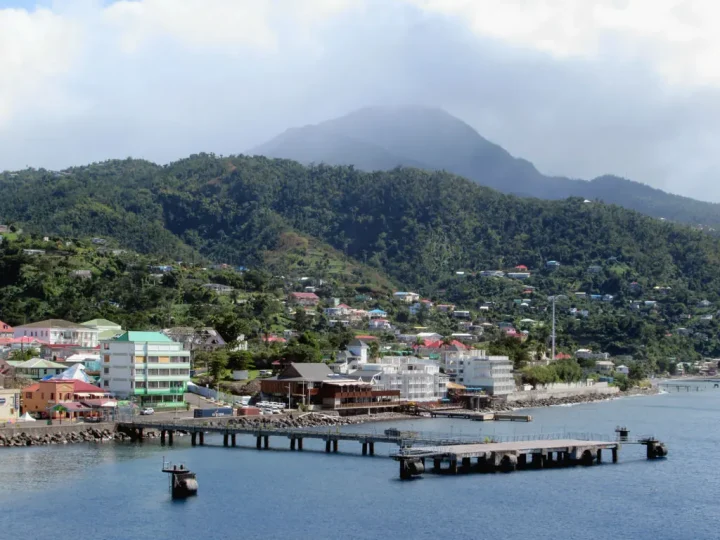
Roseau waterfront and cruise ship wharf below the mountains of Dominica
David Stanley from Nanaimo, Canada, CC BY 2.0. Source

Roseau

The capital, where most visitors land

  • Roseau is Dominica's capital and largest city, with 14,725 people at the 2011 census. Wikipedia
  • It stands on the site of the Island Carib village of Sairi and is the island's most important port for foreign trade. Wikipedia
  • The city sits between the Caribbean Sea, the Roseau River and Morne Bruce. Wikipedia

Check before you travel. Ship days are busy. Check ship times and book tours ahead.

Roseau cruise port guide Places to go

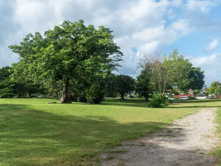
Large shade trees and lawns in the Dominica Botanic Gardens, Roseau
Tournasol7, CC BY 4.0. Source

Roseau Botanic Gardens

Green calm in the middle of town

  • The Botanic Gardens are in the middle of Roseau, the capital. Wikipedia
  • Hurricane David badly damaged them in 1979. After restoration they remain a centre of conservation research. Wikipedia

Check before you travel. Opening times and closed areas can change. Check on arrival.

Roseau Botanic Gardens guide

Soufriere Bay and the green coast of southern Dominica
Postdlf, CC BY-SA 3.0. Source

Soufriere and the marine reserve

A bay on the leeward coast

  • Soufriere is a village on the south-west coast and the capital of Saint Mark Parish, with 973 people. Wikipedia
  • Soufriere Bay is protected as the Soufriere Scotts Head Marine Reserve. Wikipedia
  • OpenStreetMap maps the Soufriere Sulphur Springs, a hot spring area, just inland. OpenStreetMap

Check before you travel. Check sea conditions and local rules before you swim, snorkel or dive.

Sea, whales and reefs

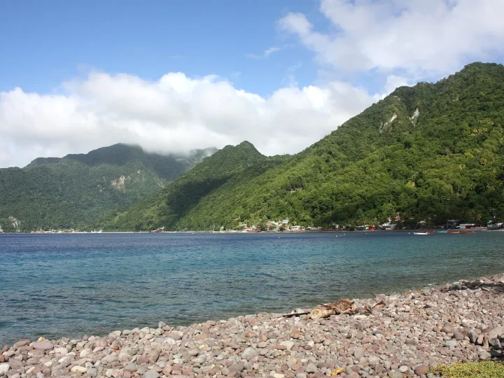
Scotts Head and a pebble beach under green volcanic hills in Dominica
Postdlf, CC BY-SA 3.0. Source

Scotts Head

The southern tip, where the coast curls

  • The village overlooks Soufriere Bay and is a popular snorkelling and diving site. Wikipedia
  • The peninsula is described as the Caribbean's only tied island. Its Kalinago name is Cachacrou, 'that which is being eaten (by the sea)'. Wikipedia
  • On top are a small lighthouse and the remains of Fort Cachacrou, an 18th-century battery. Wikipedia

Check before you travel. The climb is steep. Take water and check sea conditions before you get in.

Sea, whales and reefs

Roseau Valley and the volcanoes

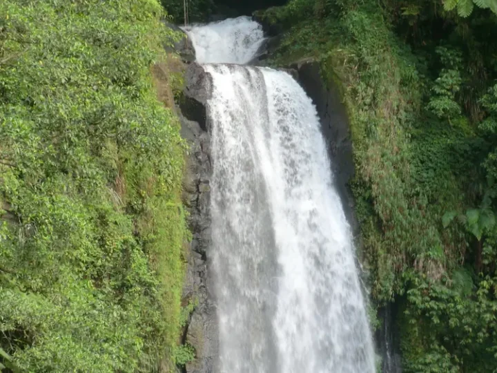
Trafalgar Falls dropping through green forest in Dominica
Reinhard Link from Germany, CC0. Source

Trafalgar Falls

Twin falls above the Roseau Valley

  • OpenStreetMap maps two falls here, labelled Papa and Mama. OpenStreetMap
  • Trafalgar village is best known for the falls and a small hydropower plant. The falls are a growing ecotourism draw. Wikipedia
  • The village lies north-east of Roseau, close to Morne Trois Pitons. Wikipedia

Check before you travel. Rivers rise fast after rain. Stay on marked paths and check conditions first.

Water adventures

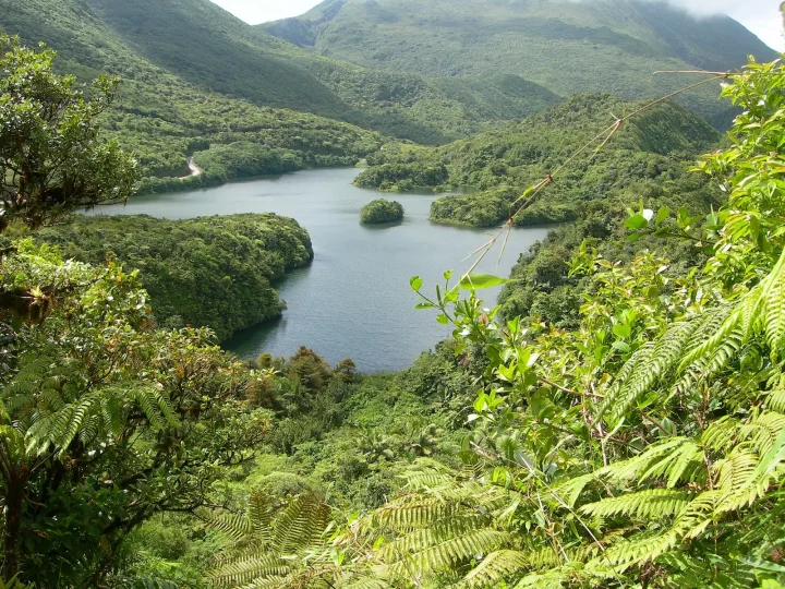
Boeri Lake seen from above, surrounded by forested mountains in Dominica
Charlottea, CC BY-SA 3.0. Source

Laudat and Boeri Lake

The gateway village in the clouds

  • Laudat is a village of just over 300 people between Morne Watt, Morne Micotrin and Morne Trois Pitons, at the end of the road. Wikipedia
  • It is the gateway to the Boiling Lake, Fresh Water Lake and Titou Gorge, and has a cool climate. Wikipedia
  • Boeri Lake is listed among the attractions of Morne Trois Pitons National Park. Wikivoyage

Check before you travel. Mountain weather changes fast. Bring a rain layer.

Walk the volcanoes

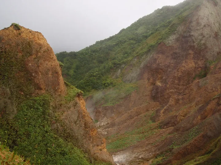
Steaming volcanic slopes in the Valley of Desolation, Dominica
Nelro (talk), Public domain. Source

Valley of Desolation

Steam vents and bubbling mud

  • It is a region of boiling mud ponds and small geysers inside Morne Trois Pitons National Park. Wikipedia
  • Sulphurous gases limit the plants to hardy species such as Clusia, grasses and bromeliads. Wikipedia
  • On the Boiling Lake trail the path is indistinct in this valley. Wikivoyage

Check before you travel. Hot ground and gas. Go with a guide and stay on the marked path.

Walk the volcanoes

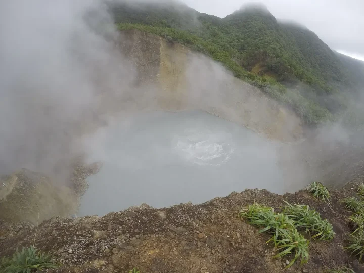
Steam rising from the Boiling Lake in Dominica
Bayukjdr, CC BY-SA 4.0. Source

Boiling Lake

A flooded volcanic vent

  • It is a flooded fumarole inside Morne Trois Pitons National Park, a World Heritage Site. Wikipedia
  • It is roughly 60 to 75 m across and is the second-largest hot lake in the world, after Frying Pan Lake in New Zealand. Wikipedia
  • Water at the edge is about 82 to 92 degrees Celsius, hotter towards the centre. Wikipedia

Check before you travel. A steep round trip of about 12 miles (around 8 hours). A guide is recommended if you are inexperienced.

Walk the volcanoes

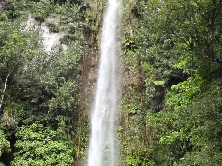
Middleham Falls, a tall waterfall in Morne Trois Pitons National Park, Dominica
Nelro (talk), Public domain. Source

Middleham Falls

A forest waterfall inside the park

  • Wikivoyage lists Middleham Falls among the attractions of Morne Trois Pitons National Park. Wikivoyage
  • All the major waterways of the southern half of the island start in this park. Wikipedia
  • The park was set up in July 1975, the first legally established in Dominica, and became a World Heritage Site in 1997. Wikipedia

Check before you travel. Forest paths are wet and slippery. Check trail conditions locally.

Water adventures

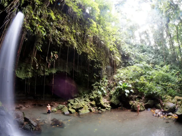
Emerald Pool: a thin waterfall dropping into a forest pool in Dominica
Aneil Lutchman, CC BY-SA 2.0. Source

Emerald Pool

A cool forest pool under a thin fall

  • Emerald Pool is one of the named features of Morne Trois Pitons National Park. Wikipedia
  • Wikivoyage suggests a swim here, with Titou Gorge as the nearby alternative. Wikivoyage
  • OpenStreetMap maps the pool and a waterfall at this spot. OpenStreetMap

Check before you travel. Paths and pool access can close after heavy rain. Check locally.

Water adventures

North forests and Portsmouth

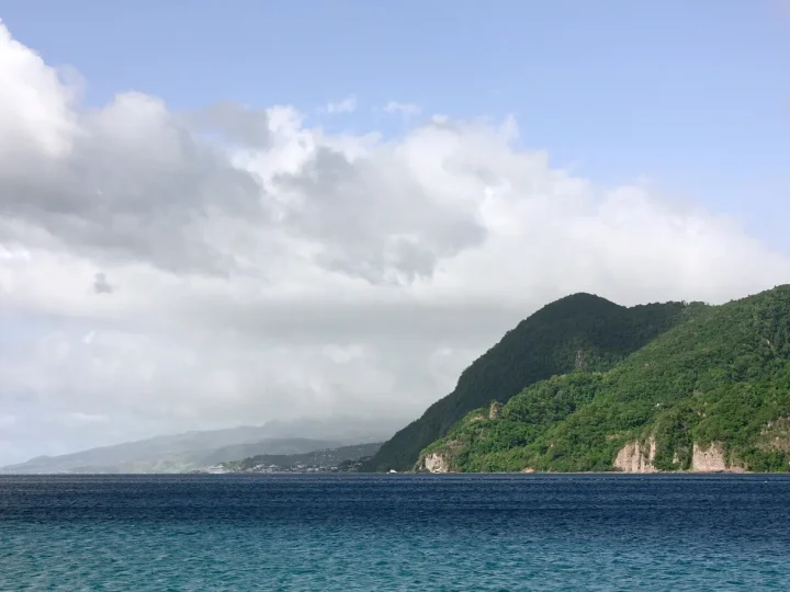
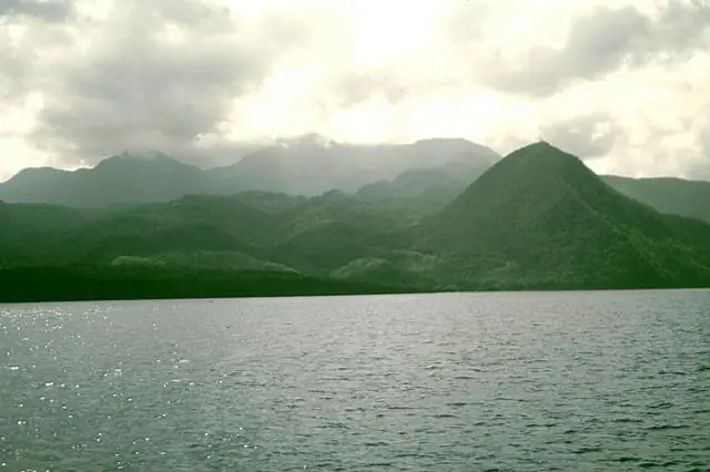
Morne Diablotin and the northern mountains of Dominica seen across the sea
Lee Siebert, Smithsonian Institution, Public domain. Source

Morne Diablotins

The roof of the island

  • At 1,447 m it is the highest mountain in Dominica and its largest volcano. It last erupted about 30,000 years ago. Wikipedia
  • The summit takes around three hours to reach. The first recorded ascent was in the late 1860s by Scottish physician John Imray. Wikipedia
  • The Sisserou is frequently found here, especially in the upper Picard River Valley on the north-west side. Wikipedia

Check before you travel. A long mountain hike. Check with the Forestry Division and go with a guide.

Meet the Sisserou Is the Sisserou endangered?

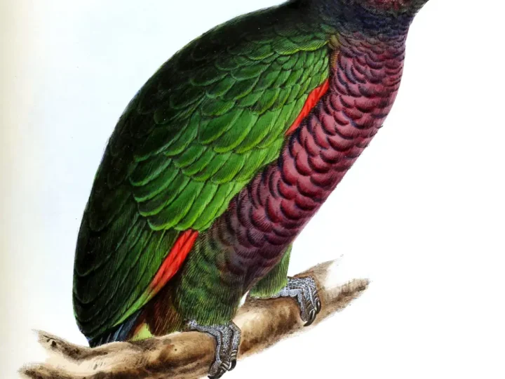
Nineteenth-century illustration of a Sisserou parrot on a branch
David William Mitchell (1813–1859), Public domain. Source

Syndicate Nature Trail

Where you might hear a Sisserou

  • It is a loop of about 1.6 km (1 mile) at the foot of Morne Diablotin, one of two nature trails in Morne Diablotin National Park. Wikipedia
  • The trail starts at the Syndicate Visitor Centre, near the edge of the Picard River Gorge. Wikipedia
  • The Sisserou lives in mountain forest above about 625 m (2,100 ft). It is shy, hard to spot and well camouflaged. Wikipedia

Check before you travel. Sightings are never guaranteed. Keep to the path and stay quiet. The picture is an old illustration, not a photograph of this trail.

Meet the Sisserou

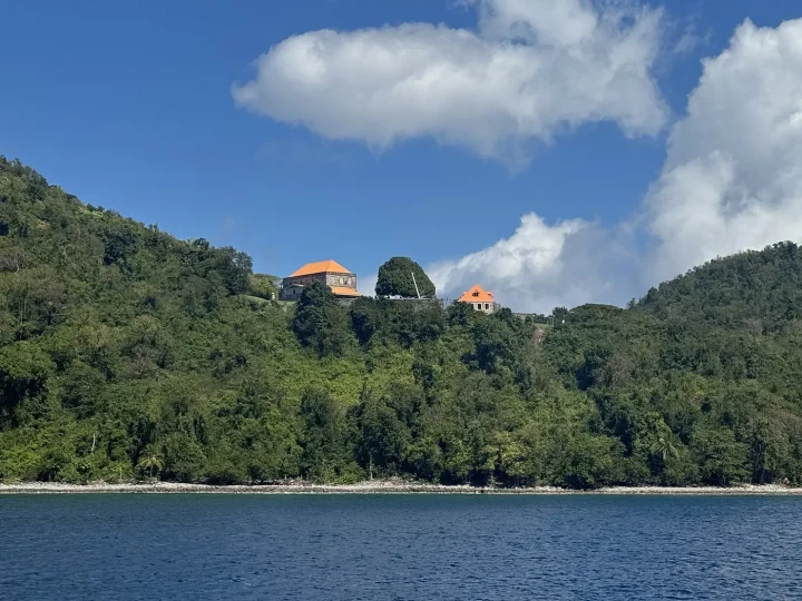
The restored Fort Shirley buildings on a forested ridge at Cabrits, Dominica
CareAhLine, CC0. Source

Cabrits and Fort Shirley

A garrison on a forest headland

  • Cabrits National Park is on a peninsula at the north end of the island, north of Portsmouth. It protects tropical forest, coral reefs and wetlands. Wikipedia
  • It has hiking trails and an English garrison called Fort Shirley. Wikipedia
  • OpenStreetMap maps ruins here including the Commandant's Quarters, Guardhouse, Officers' Quarters and Ordnance Store. OpenStreetMap

Check before you travel. Ruins have uneven ground and drops. Check opening times.

Places to go

Rowing boats waiting by the bridge on the Indian River at Portsmouth, Dominica
Cowbell Solo, CC BY-SA 2.0. Source

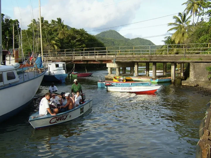
Indian River

The widest river, explored by rowing boat

  • The Indian River is the widest river in Dominica. It reaches the sea between Portsmouth and the village of Glanvillia. Wikipedia
  • Boat rides on it are one of the island's tourist attractions. Wikipedia
  • Scenes from Pirates of the Caribbean: Dead Man's Chest were filmed here. Wikipedia

Check before you travel. Boat trips run with local guides. Ask the price and what is included before you board.

Places to go

Atlantic coast

A quiet beach and pier at Calibishie on the north coast of Dominica
Hans Hillewaert, CC BY-SA 3.0. Source

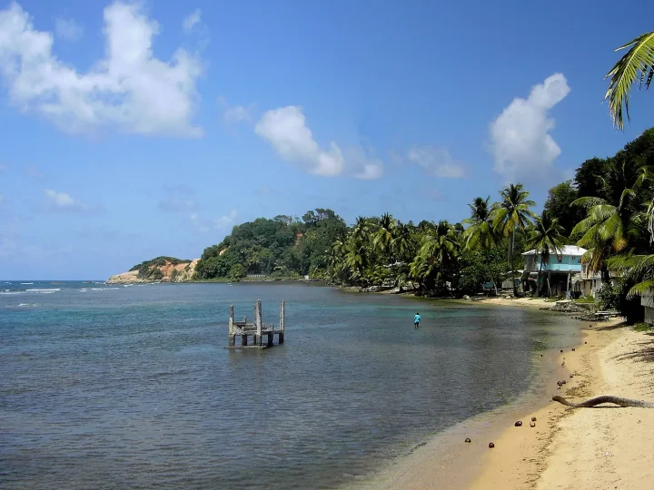
Calibishie coast

From shore to rainforest in a mile

  • On this coast you can go from the seashore to rainforest in little more than a mile. Wikipedia
  • Its beaches include Batibou, Hampstead, Hodges, Point Baptiste, Turtle and Woodford Hill. Wikipedia
  • Calibishie lies on the north-east coast, just east of Hampstead. Wikipedia

Check before you travel. Atlantic-side swimming can be rough. Ask locally which beaches are calm.

Places to go Where to stay

Surf on the sandy shore of Pagua Bay, Dominica
Hans Hillewaert, CC BY-SA 3.0. Source

Pagua Bay and Marigot

The Atlantic coast, near the airport

  • Pagua Bay is mapped on the east coast, with Pagua Hill (251 m) behind it. OpenStreetMap
  • Douglas-Charles Airport (DOM) lies on the north-east coast, about 3.2 km north-west of Marigot. Wikipedia
  • It is one of only two airports on the island. The other is Canefield, near Roseau. Wikipedia

Check before you travel. Flight schedules change. Check with your airline.

Plan your visit

Forested cliffs above Rosalie Bay on the east coast of Dominica
Postdlf, CC BY-SA 3.0. Source

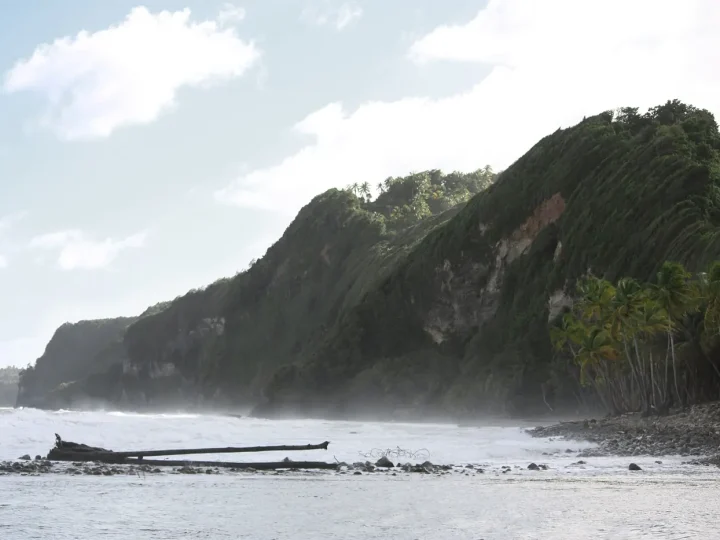
Rosalie Bay

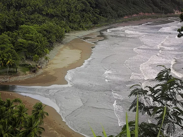
A river mouth on the Atlantic side

  • Rosalie is a village in Saint David Parish at the north end of Rosalie Bay, near the mouth of the Rosalie River. Wikipedia
  • OpenStreetMap maps Turtle Beach and a community turtle group here. OpenStreetMap
  • Dominica's waters are home to three marine turtle species: leatherback, hawksbill and green. Wikivoyage

Check before you travel. Never touch or crowd turtles, and keep lights off beaches at night.

Where to stay

Kalinago Territory

Home of the Indigenous Kalinago people

  • The Kalinago Territory is a district of about 15 square kilometres (3,700 acres) on the Atlantic coast. Wikipedia
  • British colonial authorities set it up in 1903 for the Indigenous Kalinago people. Wikipedia
  • Wikivoyage describes a guided tour of the recreated village Kalinago Barana Aute. Wikivoyage

Check before you travel. This is a living community. Visit with local guides and ask before photographing people.

Food and culture

The 5 challenges

  • River to the falls. Start at the Roseau river mouth and follow the water up the valley, through every ring, to Trafalgar Falls. All the major waterways of the southern half of the island start in Morne Trois Pitons National Park. Wikipedia
  • Through the steam. From Titou Gorge, weave through the steam plumes over the Valley of Desolation to the Boiling Lake. The Boiling Lake is usually wrapped in a cloud of vapour. Wikipedia
  • Whale bay glide. Glide north over the sea off the leeward coast and pass each spout marker, from Scotts Head towards Roseau. A group of sperm whales lives in the sea around Dominica all year. Wikipedia The markers are a game device. They are not whale positions, and sightings are never guaranteed.
  • Ride the thermal. Circle inside the rising air above Morne Diablotins until the gauge fills. The Sisserou lives in mountain forest and is a strong flyer with powerful wings. It is frequently found on Morne Diablotins. Wikipedia Rising air is a game device, not a claim about how Sisserou parrots travel.
  • Follow the Waitukubuli trail. Follow the first mapped stretch of the Waitukubuli National Trail north from Scotts Head, ring by ring. The Waitukubuli National Trail is 185 km long, the longest hiking trail in the Caribbean. Waitukubuli is the Kalinago name for the island, 'tall is her body'. Wikipedia Only parts of the trail are mapped in OpenStreetMap, so this route is a short stretch.
Map data © OpenStreetMap contributors, ODbL 1.0: coastline, rivers, forest, parks, lakes, trails and points of interest. Facts from Wikipedia and Wikivoyage (CC BY-SA), each linked at the fact. Photos are credited above and on the photo credits page. The map is stylised, so do not use it for navigation.